
YOUR LOCAL PLUMBER IN
Anmore
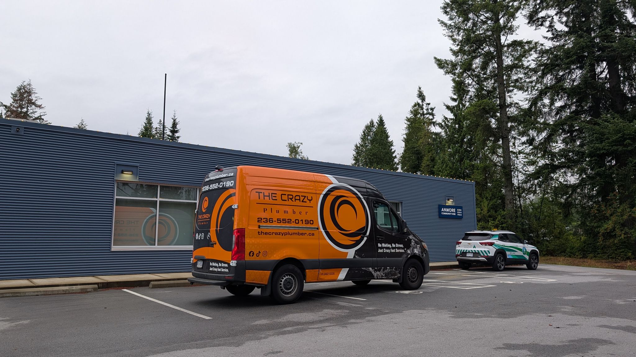
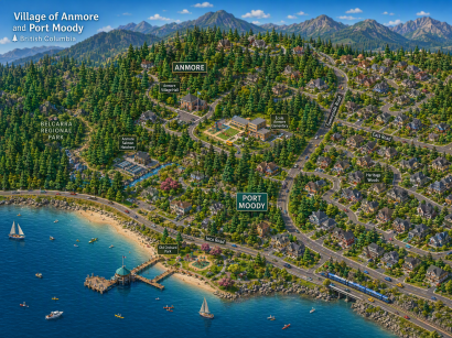
From Buntzen Lake to the Community Hub on Sunnyside Road, Anmore is a village of acreage homes and mountain trails. Explore its neighbourhoods, landmarks and home styles, then find the plumbing service you need with The Crazy Plumber.
Legend
Surveyed by
The Crazy Plumber
Port Coquitlam HQ, serving all four regions
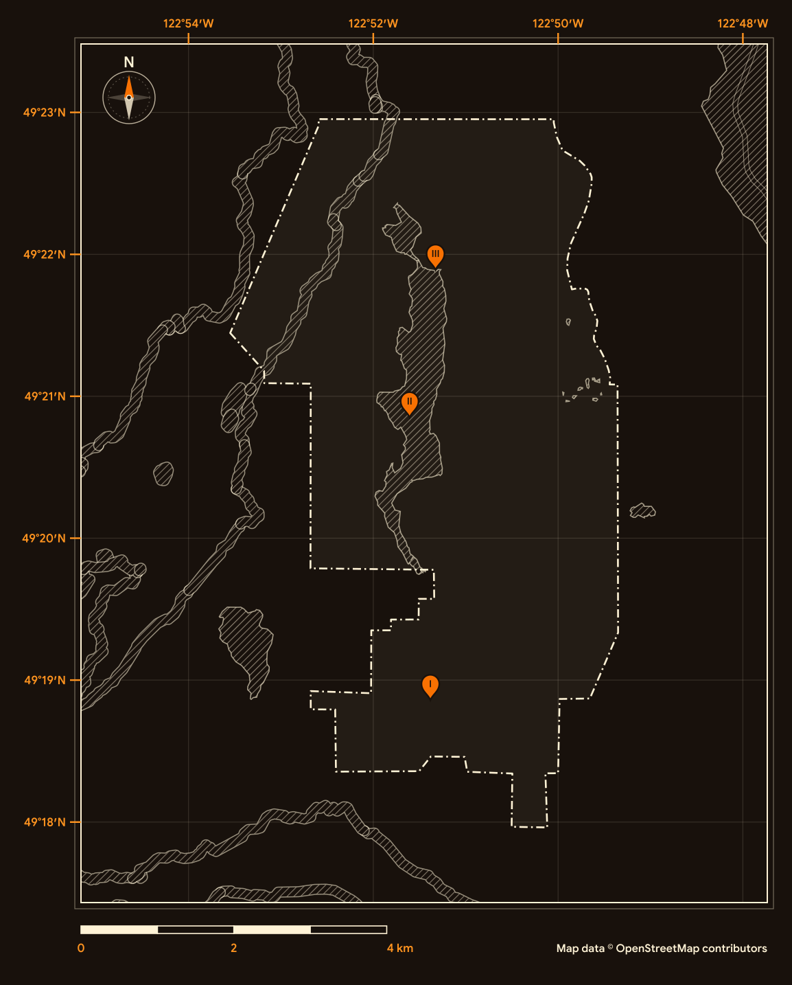
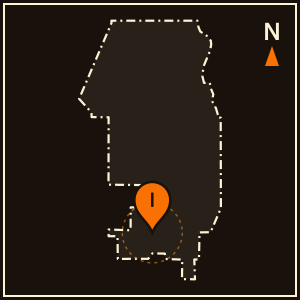
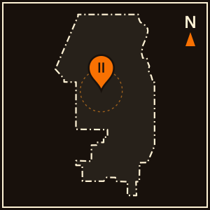
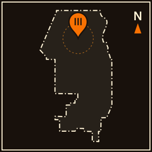
Pins I to III match the landmark plates; the dashed line is the city boundary. Map data © OpenStreetMap contributors (ODbL).
Location Landmarks
Three familiar places. Three different stories. Explore a civic hub on a pioneer homestead, a mountain lake and the tunnel that feeds it.
Anmore Community Hub
The Hub stands on the 1916 homestead site of George and Ma Murray.

Buntzen Lake
Once known as Trout Lake and Lake Beautiful, it was renamed Buntzen Lake in 1905.

The Buntzen tunnel
At its deepest, the tunnel runs 1.2 km below ground.

Your Home, Your Community, Your Plumber.
Ready to sort out your plumbing?
Tell us what is happening at home. Request a plumbing appointment online, or call to discuss the next step.
Credentials on file
Licence
TSBC Licence # LGA0213328
Better Business Bureau
Accredited · A+ ratingGoogle reviews
854
Founded
June 2023, Port Coquitlam
Estimates
Free estimates
I had an excellent experience with Crazy Plumber! They were professional, punctual, and completed the job quickly with great attention to detail. Communication was clear from start to finish, and they left everything clean after the work was done. The quality of the installation exceeded my expectations, and their pricing was fair. I highly recommend Crazy Plumber to anyone looking for reliable and trustworthy plumbing services. Thank you for the outstanding work!
Super quick response, good communications, drain digging and repair done the next day. So happy with Ryan’s work.
The Crazy Plumber is a reliable and professional operation. Brad is courteous, he takes time to answer questions, he knows his trade well and he works hard when he is on the job. I highly recommend The Crazy Plumber for any and all of your plumbing needs.
Recently moved into our condo and the bathroom faucet was dripping. Rob came by and did what he could however the tap ended up being discontinued. They came through though and got us hooked up with a new tap and shower head at a great price. Can not say enough great things about the service we have received, and the great attitude and professionalism from Rob. We will recommend to our friends and fam!
Huge shoutout to The Crazy Plumber! They came out and fixed my sink, and I honestly couldn’t be happier with the service. They were friendly, professional, and knew exactly what they were doing. One thing I really appreciated was that they cleaned everything up before they left. It’s the little things like that that make such a difference. It’s not often you find someone who’s reliable, does great work, and leaves your home cleaner than when they arrived. I’ll definitely be calling them again if I ever need a plumber, and I’d recommend them to anyone without hesitation! Thanks again! 😊
Location Data
See how Anmore grew, what kinds of homes it has, how old they are and who calls it home. Explore five views of the 2021 Census.
Residents
2,356
Earlier census
2,210
Census year
2021
Comparison year
2016
People per square kilometre
85.6
Land area (km²)
27.5
Private dwellings
768
Occupied by usual residents
744
Average household size
3.2
Households of one person (%)
11.4
Median age in years
45.6
Ages 0 to 14 (%)
14.6
Ages 15 to 64 (%)
72.2
Ages 65 and over (%)
13.2
Average age in years
41.2
Ages 85 and over (%)
0.8
Single-detached (%)
71.1
Apartments, 5 or more storeys (%)
0.0
All other home types (%)
28.9
Households that own (%)
91.3
Households that rent (%)
8.7
Median home value, owner-estimated
$2,200,000
Built 1981 to 2000 (%)
35.6
Homes built 1981 to 2000
265
Built before 1981 (%)
12.8
Built 2001 to 2021 (%)
53.7
Needing major repairs (%)
4.7
Homes needing major repairs
35
Historical Timeline
Stump ranches, a refinery next door and a village of its own. Explore three turning points that helped shape Anmore.
1914
Homesteads in the valley
On September 9, 1914, the Dominion Government auctioned land in the Buntzen Valley as homesteads. Settlers had to clear at least two acres and build a dwelling valued at $300 or more before receiving title.
Early settlers called the logged landscape stump land. The community was known as Sunnyside until the local post office adopted the name Anmore.
1915
A refinery and a road
In January 1915, the Imperial Oil refinery at nearby Ioco began operations. That same year, a rough logging trail around the north shore of Burrard Inlet gave settlers their first road connection to Ioco, replacing travel by boat.
Settlers also formed the Farmers’ Institute to buy supplies in bulk and lobby for roads and a schoolhouse.
1987
A village of its own
Residents shaped the Anmore Concept, a small-is-beautiful approach built around acreage parcels and local governance. The Village of Anmore incorporated on December 7, 1987.
Founding mayor Dr. Hal Weinberg and council first conducted civic business from a trailer at Sunnyside and East Roads.
Neighbourhoods
Explore three different sides of Anmore: Countryside Village, Anmore Green Estates and Crystal Creek. Choose a neighbourhood to see its homes, streets and setting.
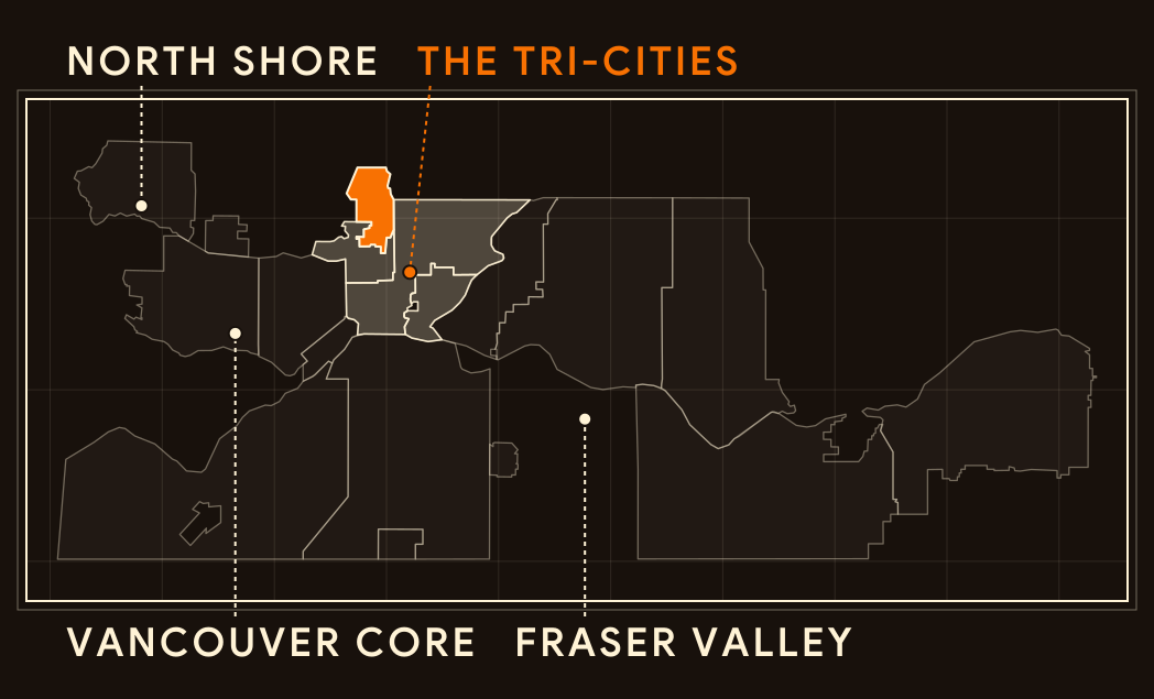
Regional key
The Tri-Cities
Map data © OpenStreetMap contributors (ODbL)
Countryside Village
Across from the Buntzen Lake access, a former mobile home park is gradually becoming a street of custom homes.
Homes
From manufactured homes to custom builds
The property became a bareland strata with individually titled lots in 2009. Owners have since been replacing the manufactured homes with larger custom houses, many of them built from 2016 to 2019.
Streets
One address, many lots
All 92 lots share the address 3295 Sunnyside Road. The community began in 1971 as a mobile home park of 88 units on A.H. Peppar’s land and fish hatchery, at the north end of Sunnyside Road.
Setting
At the end of the road
The community sits at the north end of Sunnyside Road, near the Buntzen Lake entrance. Like most of Anmore, it has no municipal sewer and treats its wastewater on site.
Anmore Green Estates
A compact strata community on the Port Moody boundary, set above Eagle Mountain Middle School.
Homes
Houses replace mobile homes
The site was a mobile home park, with a septic system permitted in 1978. It was redeveloped in 1999 as a strata of 51 homes.
Streets
Close to the boundary
Anmore Green Estates sits on a hillside above Eagle Mountain Middle School and Heritage Woods Secondary, beside the Port Moody boundary. Most of the rest of the village relies on septic systems.
Setting
Linked to Port Moody
In February 2020, council approved a local area service bylaw so the strata could pay to connect to regional sewer. The strata owns the connection to the Port Moody system, about 60 metres away.
Crystal Creek
A subdivision of 35 homes along Crystal Creek Drive, served by its own shared wastewater system.
Homes
A small subdivision
Crystal Creek Estates is a residential subdivision of 35 homes around Crystal Creek Drive and Westridge Lane.
Streets
A shared treatment plant
Most Anmore homes use their own septic fields. Crystal Creek Estates is served instead by a communal wastewater treatment plant, regulated by the province and Fraser Health rather than the Village.
Setting
Next to Anmore South
The neighbourhood borders Anmore South, a 62-hectare property proposed for new homes. Council’s preferred plan for it includes a street link to Crystal Creek Drive and a 15-metre tree buffer.
Builders and Developers
Meet the early homesteaders and a local family whose work helped shape Anmore. Follow each story from the land to the homes people recognise today.
The Sunnyside homesteaders
Material
Stump land to clear.
Logging and fire before 1900 left the Anmore valley covered in burnt stumps and bush. Early settlers called it stump land, and from 1915 the Farmers’ Institute bought stumping powder in bulk.
Building
A home worth $300.
After the government land sale in 1914, settlers had to live on the land, clear at least 0.8 hectares and build a home worth $300 or more before a federal inspector approved their title.
Community
From shacks to houses.
Early homes were tents or one-room shacks. By the later 1920s, houses were built for comfort, and a one-room schoolhouse built in 1916 at East and Sunnyside Roads served as the valley’s hall.
The Smurthwaite family
Material
A homestead changes hands.
Newspaper publisher Margaret “Ma” Murray and her husband George homesteaded in the Anmore area from 1917 to 1934. By 1988, their former house belonged to the Smurthwaite family.
Building
A house becomes a village hall.
In 1988, the Village of Anmore bought the land with help from the provincial government, and the Smurthwaites donated the house. The heritage home became the municipal hall and held a museum on the Murrays.
Community
A new hall for the village.
The old house was deemed uninhabitable in 2016. Members of the Smurthwaite family joined the June 2022 groundbreaking for the Anmore Community Hub, the first purpose-built municipal facility in the village.
Styles of Homes
Recognise that roofline? Choose a home style, then explore the details that connect it with Anmore.
1914 to the 1950s
Homestead beginnings
Anmore’s first homes were built to meet homestead rules. Tents and one-room wood shacks gave way to more permanent cedar-sided houses.
Built to a requirement
Homesteaders had to build a dwelling valued at $300 or more before receiving title.
A modest family home
The 1916 Ma Murray house was an 800 square foot, two-storey wood dwelling.
Few survive today
In the 2021 Census, 35 occupied homes, or 4.7% of the stock, dated from 1960 or earlier.
1980s and 1990s
Room to spread out
The 2021 Census counted 265 Anmore homes built from 1981 to 2000. The village grew on acreage lots rather than suburban subdivisions.
Houses on acreage
Residents backed the Anmore Concept, a plan for a “ruggedly individual way of life” with limited services, houses on acreage and community control of local issues.
Large lots by design
Apart from two mobile home parks, homes in Anmore were built on large lots with a minimum of five acres, or about two hectares.
Growth after incorporation
Anmore became a village in December 1987. The 2021 Census counted 205 occupied homes built from 1991 to 2000, up from 60 built from 1981 to 1990.
2000s onward
Indoors meets outdoors
More than half of Anmore’s homes were built in 2001 or later: 400 of the 745 occupied homes counted in the 2021 Census.
Posts, beams and glass
West Coast design grew from modernist ideas and a rainforest climate. Look for deep eaves, exposed post-and-beam structure and walls of windows that open toward the garden.
Mostly detached houses
Of the 745 occupied homes counted in Anmore in 2021, 530 were single-detached houses. The census counted no row houses or apartment buildings.
A form, not a floor plan
Homes of this era vary widely.