
YOUR LOCAL PLUMBER IN
West Vancouver
From the Ambleside waterfront to the curving roads of the British Properties, West Vancouver has more than one story to tell. Explore the neighbourhoods, landmarks and home styles that shape the District, then find the plumbing service you need with The Crazy Plumber.

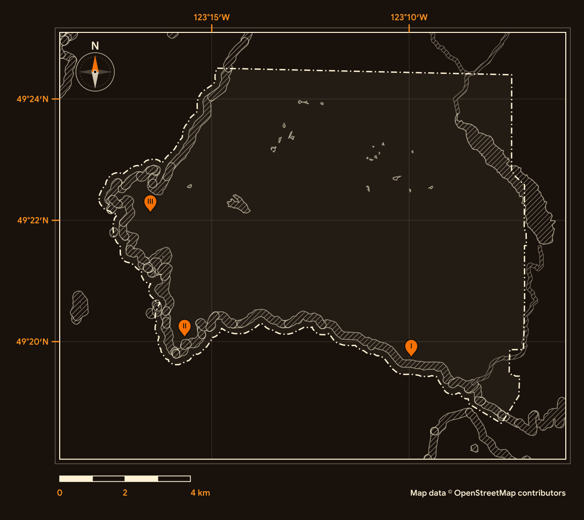
Legend
Surveyed by
The Crazy Plumber
Port Coquitlam HQ, serving all four regions
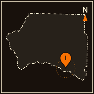
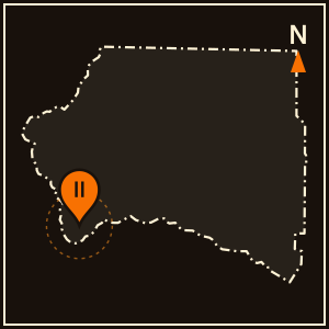
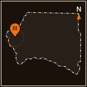
Pins I to III match the landmark plates; the dashed line is the city boundary. Map data © OpenStreetMap contributors (ODbL).
Location Landmarks
Three familiar places. Three different stories. Explore a memorial library, a lighthouse forest and a ferry terminal at Horseshoe Bay.
West Vancouver Memorial Library
The library was approved by municipal plebiscite by a margin of one vote.

Lighthouse Park
About 10 kilometres of trails include Valley of the Giants and the Coastal Loop.

Horseshoe Bay Ferry Terminal
The terminal marks the western end of the Trans-Canada Highway.

Your Home, Your Community, Your Plumber.
Ready to sort out your plumbing?
Tell us what is happening at home. Request a plumbing appointment online, or call to discuss the next step.
Credentials on file
Licence
TSBC Licence # LGA0213328
Better Business Bureau
Accredited · A+ ratingGoogle reviews
854
Founded
June 2023, Port Coquitlam
Estimates
Free estimates
Karn Atwal helped us out by fixing our water temperature he was on time and out within 5 minutes after a simple fix and was super knowledgeable and helpful!
Ryan, was incredibly prompt and fixed our broken shutoff valve in no time. Great to have peace of mind and know we don’t have to worry about any further leaks!
Ryan was personable and friendly explained problem with kitchen faucet and had it repaired in minutes. Service was prompt and much appreciated. Thankyou Diana
Brad and Karn were so prompt to reply to my emergency and made sure that I understood everything they were doing and worked tirelessly to resolve the issue. It’s the second time I’ve used this company and wouldnt hesitate to call them again
Ryan was amazing, came in very knowledgeable, gave me a reasonable price and boom I had my toilets working in less than an hour. Amazing service, highly recommend.
Karn from the Crazy Plumber helped me out on short notice with a gas patio heater I was having problems with. He was very easy to communicate with and gave me some different solutions to consider. I would definitely recommend these guys to anyone needing help with their plumbing or gas issues.
Location Data
See how West Vancouver grew, what kinds of homes it has, how old they are and who calls it home. Explore five views of the 2021 Census.
Residents
44,122
Earlier census
42,473
Census year
2021
Comparison year
2016
People per square kilometre
506.1
Land area (km²)
87.2
Private dwellings
18,795
Occupied by usual residents
17,690
Average household size
2.5
Households of one person (%)
28.0
Median age in years
50.8
Ages 0 to 14 (%)
14.0
Ages 15 to 64 (%)
57.5
Ages 65 and over (%)
28.5
Average age in years
47.6
Ages 85 and over (%)
5.4
Single-detached (%)
55.6
Apartments, 5 or more storeys (%)
21.5
All other home types (%)
22.9
Households that own (%)
70.9
Households that rent (%)
29.1
Median home value, owner-estimated
$2,500,000
Built 1981 to 2000 (%)
25.9
Homes built 1981 to 2000
4,575
Built before 1981 (%)
53.8
Built 2001 to 2021 (%)
20.3
Needing major repairs (%)
5.2
Homes needing major repairs
920
Historical Timeline
A new municipality, a hillside land purchase and a bridge to Vancouver. Explore three turning points that helped shape West Vancouver.
1912
A municipality of its own
The District of West Vancouver incorporated on March 15, 1912, separating from the District of North Vancouver. Voters elected Charles Nelson as the first reeve on April 6, and that same year the new municipality took over the ferry service to Vancouver.
1931
A hillside company arrives
In 1931, members of the Guinness family formed British Pacific Properties Limited and acquired land on Hollyburn Ridge for $75,000, committing $1,000,000 to infrastructure over five years. The Olmsted Brothers firm designed the initial 1,000-acre master plan in 1933.
1938
A bridge to the city
Financed and built by British Pacific Properties for $5.87 million over 17 months, the Lions Gate Bridge opened to traffic on November 14, 1938. King George VI and Queen Elizabeth crossed it in 1939, and it was designated a National Historic Site of Canada in 2005.
Neighbourhoods
Explore three different sides of West Vancouver: Dundarave, Ambleside and the British Properties. Choose a neighbourhood to see its homes, streets and setting.
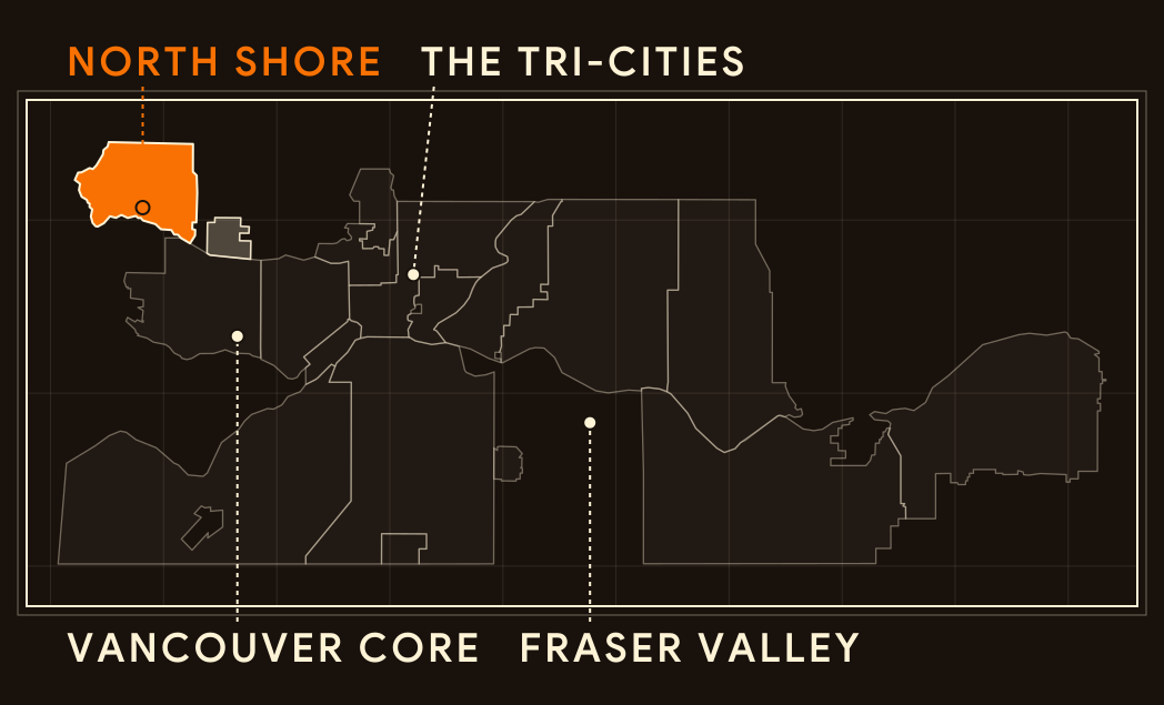
Regional key
North Shore
Map data © OpenStreetMap contributors (ODbL)
Dundarave
A seaside village west of Ambleside, named after Dunderave Castle in Scotland.
Homes
A mix of village homes
Single-detached homes, character duplexes and low-rise apartments share the streets. Early resident Russell Macnaghten and partners bought and subdivided land here in 1909.
Streets
A stop on the railway
The Pacific Great Eastern Railway opened a stop at 25th Street under the Dundarave name in 1914. Today the village shops and cafés line Marine Drive between 24th and 26th Streets.
Setting
Where the seawalk ends
Dundarave grew from a summer camping retreat into a permanent village around the First World War. Its pier marks the western end of the Centennial Seawalk.
Ambleside
West Vancouver’s town centre, laid out on a flat, walkable grid along Burrard Inlet.
Homes
Apartments near the water
A 1959 rezoning opened Ambleside to apartment buildings. The Crescent Apartments, completed in 1961, became the District’s first residential high-rise.
Streets
A walkable main street
Marine Drive between 13th and 19th Streets is the commercial spine, with shops, restaurants and services. Unlike the steep slopes elsewhere in the District, Ambleside sits on a flat gridiron plan.
Setting
A beach made by hand
Ambleside Park was designated in 1918. In 1964, its tidal slough was filled with sand and gravel to create the beach people know today.
British Properties
A master-planned hillside area on the slopes of Hollyburn Ridge, shaped by its roads and views.
Homes
Large homes on view lots
Large single-family homes on hillside view lots make up most of the area. Most were built between 1955 and 1985, with some earlier and some later.
Streets
Roads that follow the slope
The Guinness family’s British Pacific Properties acquired the land in the early 1930s. The Olmsted Brothers firm of Boston designed the original plan, with roads that follow the rugged slope.
Setting
A mountainside setting
The area climbs the slopes of Hollyburn Ridge. The Guinness interests also built the Lions Gate Bridge as part of developing the British Properties, linking the hillside to Vancouver.
Builders and Developers
Meet two designers whose work helped shape West Vancouver. Follow each story from materials to buildings and the places people recognise today.
Gertrude Lawson
Material
Stone sets the character.
Gertrude Lawson House is recorded as a Scottish manorial stone residence in Ambleside.
Building
She designed and supervised her own build.
Completed in 1940 at 680 17th Street in Ambleside, the house was designed by Gertrude Lawson, who also supervised its construction.
Community
A home becomes a museum.
Gertrude Lawson House is listed on the District’s Community Heritage Register and is now home to the West Vancouver Art Museum.
Ron Thom
Material
Wood becomes the structure.
Ron Thom’s 1954 Boyd House used exposed post-and-beam construction and plain local materials: clear tongue-and-groove cedar, a cedar-shake roof, cinder block and a south-facing window wall.
Building
A house on Eyremount Drive.
The Forrest Residence at 1143 Eyremount Drive, designed with Dick Mann and built in 1962 to 1963, won a Massey Medal in 1964. Fred Hagell was the general contractor.
Community
Homes that stay part of the streetscape.
Earlier Thom homes include the Boyd House (1954) at 985 Duchess Avenue and the Anderson House (1956) at 1655 Ottawa Avenue. The Boyd House was protected in 2020 through a heritage revitalization agreement and designation.
Styles of Homes
Recognise that roofline? Choose a home style, then explore the details that connect it with West Vancouver.
1910s to the 1930s
Craftsman character
Permanent homes followed the 1909 ferry service to Ambleside. Many of West Vancouver’s early houses, especially from the 1920s, were modest cottages and Craftsman houses.
Cedar on the outside
Wood-frame construction with cedar shingle cladding, wrap-around verandahs and battered porch piers mark the surviving examples.
A roofline worth noticing
The 1923 Rush House at 1195 12th Street has a gabled roofline, triangular eave brackets and flared window surrounds. A 2017 heritage designation bylaw protects it.
Modest and lasting
Vinson House at 1425 Gordon Avenue is a very early, unusually intact Craftsman bungalow, also called a California bungalow. A 2016 heritage designation bylaw protects it.
1950s to the 1970s
Post-and-beam on the hillside
West Coast Modernism grew as a response to the coast’s rainforest climate and steep terrain, favouring open plans and exposed structure.
Follow the beams
Exposed post-and-beam timber framing carries flat or low-pitched roofs, with cedar and other wood siding on the walls.
Glass and shelter
Large glazed panels and clerestory windows near the ceiling pair with deep eaves, linking the rooms with the landscape outside.
Where it began
The B.C. Binning Residence (1941) at 2968 Mathers Crescent is a National Historic Site. Its stepped plan follows the slope of the land.
2000s onward
Stepping down the slope
Contemporary West Vancouver homes on steep lots revisit mid-century West Coast ideas, with stepped plans, large areas of glass and deep overhangs.
Follow the contours
Stepped plans follow the slope of the land. The 1941 Binning Residence used this approach, which influenced homes through the 1950s and 1960s.
Built for the slope
Under the Community Charter, a building inspector can require a report from a qualified engineer or geoscientist before building on land subject to land slip or rockfall.
Mid-century roots
Many recent hillside homes echo West Coast modern features such as large glazed panels, deep eaves and flat or low-pitched roofs.